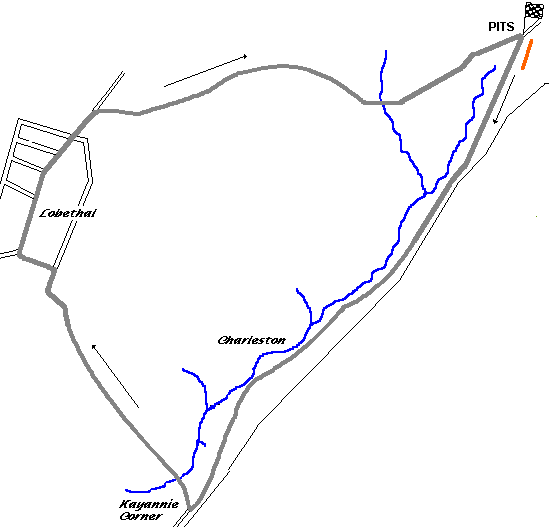
Kayannie Corner was a 60 degree corner leading to a gentle downhill river crossing and a climb to a brow of a hill overlooking Lobethal itself. From here the track followed a series of downhill esses which led into town after a final left hand bend. The road then dropped away as the T-junction with the main street was reached. The circuit then climbed again, with a dip towards the end of the shopping centre before swinging right and beginning three miles of ups and downs and blind brows towards the finishing line.
The final meeting here was held on New Years Day, 1948.